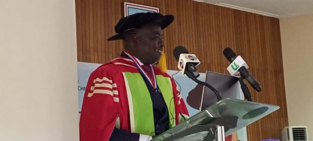
The University of Mines and Technology (UMaT), Tarkwa, in the Western Region has held its 8th inaugural lecture on the topic; “Mapping the Poor in Ghana: A Geospatial Multidimensional Poverty Index Approach.”
The Vice Chancellor of the UMaT, Professor Richard Kwasi Amankwah, in his welcoming address, explained the importance of inaugural lectures and said it was a significant milestone in any academic career, recognizing their profession progressing to professor.
He said it provided their professors with the opportunity to share their achievements, research, innovation, engagement and teaching activities before an audience of the University community and the public.
According to him, “The good thing about inaugural lecture was that one of the few times that a professor can tell us what he likes, and nobody has the right to ask him any question. He comes around, professes and it is finished.”
“Lectures of this kind have been going on in this University and am happy to say we have about six people here who have given their inaugural lectures. Today is a great day because one of our best Professor’s is going to give his inaugural lecture”. Prof. Amankwah added.
Presenting the lecture, Prof. Bernard Kumi-Boateng, Dean of Planning and Quality Assurance and a member of the University Appointment and Promotion Committee, in his address said poverty was something that had flaked the country for sometime.
“In my inaugural lecture, I am looking at how we can make use of data geospatial to harness these gaps that we have so we can manage the situation.
From our research we observed that, the Ghana Statistical Service takes a lot of data, but it remained textual. We are saying that if we can have a multi-faceted approach to it then we can target the various indicators,” he stated.
Prof. Kumi-Boateng noted that “for instance, we have dimensions such as education, health, drinking water, child mortality, among others. We have the capability to map them, and help policy makers to target, which areas are endemic.
The study sought to use geospatial technology such as Geographic Information System (GIS) to map out poverty-endemic areas by displaying the spatial dimensions of poverty and identifying the poverty pockets across the country by adopting a Multi-dimensional Poverty Index (MPI) Approach”.
“The multi-dimensional approach simply means that don’t elevate only income as a single source to determine who a poor person is, look at education, health and living standard conditions of the people, put all of them into a basket and analyze them.
So do not only say the minimum wage is this and therefore I am using them to define that,” he explained.
He emphasized that results of the study showed that across Ghana, a considerable percentage of households were deprived of several non-monetary poverty indicators.
Prof. Kumi-Boateng said the MPI incidence of the Greater Accra Region was 22.5% and Ashanti Region was 31.1% were significantly lower than the MPI incidence of the remaining regions in Ghana, suggesting that the Greater Accra and Ashanti regions were the least poor when the incident ratio was considered.
The five northern regions, he added, recorded the highest poverty incidence ranging from 65.5% to 80%, poverty headcount (incidence) also remained high in the Volta Region at 58.2%.
“From the maps that we produced, the whole country is virtually living in poverty, with the exception of Ashanti and Greater Accra Regions.
The two regions are rich, but when you apply geospatial data, you are able to determine that even though when you put all in a basket, MPI Greater Accra is rich but when you isolate the indicators Greater Accra is overcrowded and it is deprived,” he further noted.
Prof Kumi-Boateng said, “You have more than three people living in a room and they are also deprived when it comes to drinking water. So central government in targeting poverty alleviation policies should target Greater Accra for only drinking water and overcrowding. They should increase housing”.
He was optimistic that to be able to make effective poverty alleviation interventions, there was the need to produce a poverty map to assist policy makers.


